
Short walks in and around Hope Cove
Welcome to our walking guide. On this page we have four short walks that originate in Hope Cove
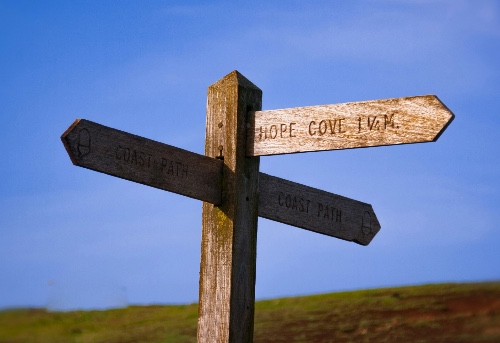
We also have information on the South Hams Way and the South West Coast Path.
Walk 1. Hope Cove to Bantham
This relatively short walk of four miles/six kilometres runs from the pretty fishing village of Hope Cove to the mouth of the river Avon. Along the route approximately one mile/1.5 km from Hope Cove is Thurlestone Sands and South Milton Ley – the second largest reed bed in Devon and an RSPB nature reserve. Across the small wooden bridge is Thurlestone village with its famous golf course, and traditional local pub called 'The Village Inn'.
The coastal path runs along the edge of the golf course so beware of errant golf balls! As you round the headland Bantham beach comes into full view – this is a popular beach with surfers and windsurfers, who provide good entertainment with their daredevil activities. As you cross the beach and wander a short way up the riverside there is a small ferry waiting to take you across to the other side where you can continue your walk to Bigbury Bay and beyond.
The ferry runs only infrequently during the summer and not at all in the winter, so be careful not to get stuck as it is a very long trek to the next crossing at Aveton Gifford. The village of Bantham is a five minute walk from the beach where The Sloop Inn offers refreshments to weary walkers.
Click here to view/download the walk PDF
Walk 2. Hope Cove to Salcombe
Leaving the village of Hope Cove in the opposite direction offers a longer coastal journey of 7½ miles/12 km to Salcombe. Starting in Inner Hope, the path wends its way to the top of Bolt Tail providing impressive views all the way to Cornwall in the east (on a clear day). The path continues onwards to Bolberry Down which, during the Second World War, was used as a Royal Air Force base. The old concrete buildings can still be seen near the disused runway.
The path then brings you down into Soar Mill Cove, a small sandy beach suitable for bathing. A steep path then leads you up to splendid views to the west towards Bolt Head. As you head towards Bolt Head keep an eye out for Grey Seals basking on the rocks below. As you round Bolt Head, Devon's most southerly point, Prawle Point, can be seen in the distance before you descend into the valley behind Starehole Bay.
The path then joins Courtenay Way that marks the final part of your journey into Salcombe. As the coastal path finishes you pass Overbecks, a National Trust museum with impressive gardens containing many tropical plants. For those feeling the strain of the miles already walked, the South Sands Ferry is waiting to complete your trip into Salcombe town. Otherwise, the road winds its way around the edge of the Kingsbridge estuary for approximately 2 miles/3 km to take you into the town where a bus or taxi can return you to Hope Cove via Malborough in about 20 minutes.
Click here to view/download the walk PDF
Walk 3. Circular Walk Starting and Finishing in Outer Hope
Follow the coastal path towards Thurlestone up the steep hill and on through the gate to a dip, which overlooks Beacon Point. Follow the right fork of the path, as the left is impassable due to erosion. As you reach the bottom of the next hill the path bends to the right and goes through a gate down to the road. Follow the road away from the beach, up the valley towards South Huish Farm. Opposite the road to the farm is a narrow lane, follow this up the hill until you come into a field. Keep forward, with the hedge on your left, to a gate on to the road.
Turn left, and after 40 metres cross a stile in the hedge on your right and go straight across the field to a short track into the road. Turn right along the road then left down a lane on the far side of the first house. Turn left at the road, and then right into Benns Close, at the bottom of which climb the post and rail barrier and continue down the field to the footbridge. Cross the field to a stile in the hedge, which leads to a well-defined track.
Go along the track and up the field to a stile in the wall beside a gate. Turn right over the stile and on to the ridgeway path, keeping the hedge on your left. Follow the hedge through several fields to come out at a gate and down to the road. Cross the road and go down the steps to the left of the chapel, and take the first turn to the right back along the path to Outer Hope Cove.
Click here to view/download the walk PDF
Walk 4. Circular Walk Starting and Finishing in Inner Hope
Follow the coastal path towards Salcombe as in walk 2. When you arrive at Bolberry Down instead of continuing along the Coast path turn left towards the radio masts and cross the cattle grid. Follow the road to a T-junction, continue forward and at the next junction turn down steeply to the right. At the top of a short hill, continue down a green lane to North Bolberry. Turn left, go along the drive almost to the gate where you will see a narrow footpath.
This leads to a stile, cross the field to another stile. Continue with the hedge on your right. Turn left and go over a wall stile by a gate and continue along the ridgeway with the hedge on your left, through several fields, to come out at a gate, and down by houses to the road. Cross the road and go down the steps to the left of the chapel. Turn left and follow the path back to Inner Hope.
Click here to view/download the walk PDF
South Hams Way
Read more about the newly formed South Hams Way...